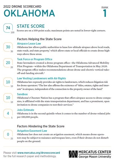
According to the Mercatus Center at George Mason University, Oklahoma is ranked number one as the most drone-friendly state in the U.S. The study analyzed six different factors, including: airspace lease laws, avigation easement laws, task force or program office, law vesting landowners with air rights, a sandbox for testing new technologies, and job estimate. Oklahoma has a drone program office that was established in 2021 by the Oklahoma Legislature and placed within the Oklahoma Aeronautics Commission through Senate Bill 659. State Director of Aeronautics, Grayson Ardies says, "The innovation of this new flying machine has been transformational for the aviation industry in many regards but has also provided benefits to a multitude of non-aviation industries as well. Both the government and private sectors have taken advantage of unmanned aerial systems (UAS) and will continue to do so as the regulatory environment at the state and federal level permits."
Another Senate Bill 1688, which became law in 2020, created the Advanced Mobility Program Advisory Council within the Oklahoma Department of Transportation and directed the Oklahoma Secretary of Transportation to appoint a nine-member council to provide recommendations on policy and regulatory issues related to the adoption of advanced mobility technologies.
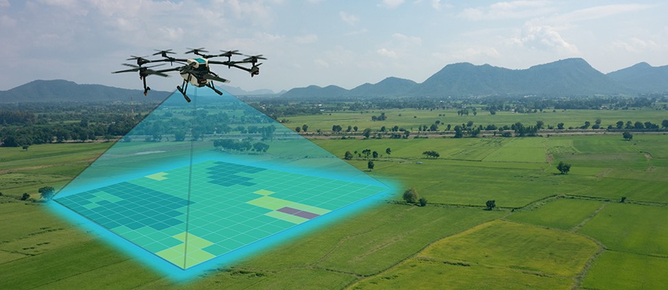
Across the globe, companies are testing drones in areas of agricultural, medical and home delivery services, however the U.S. has fallen behind due to difficulties between state and federal jurisdiction in drone and airspace management. States can create drone highways, which are aerial corridors above public roads, to open the opportunity for the drone industry and allow drone operations in low-altitude airspace while Congress and the FAA create federal regulations.
Rose State College is now offering a micro-credential course called Drone Mapping, Photography & Videography. The two-day, 12-hour course is taught by Dr. Ryan Stoddard. Stoddard is a military veteran and is the Dean of the Rose State College Engineering and Science Division.
Course topics include safety, preflight planning, airborne photography and videography, selecting and pairing mapping software and drone hardware, and uploading data for processing and exploring mapped data.
While the Drone Mapping, Photography and Videography class is not new to Rose State College, the expanded opportunity to earn an sUAS Mapping micro-credential is endorsed by the Oklahoma State Regents for Higher Education (OSHRE), which adds rigor and context to the program. Additionally, students who complete the three requirements necessary to earn the sUAS Mapping micro-credential could be eligible for reimbursement of the class fee and FAA Part 107 exam fee using OSHRE micro-credential scholarship money.
The sUAS Mapping micro-credential is the first-of-its-kind in the state of Oklahoma. It provides simple, yet in-depth instruction for new professionals and amateur drone pilots who want to learn the basics of aerial photography, videography and mapping.